🚀 Introduction: Why LiDAR is a Game Changer
LiDAR (Light Detection and Ranging) is redefining how we perceive and model the physical world. Using laser light pulses to generate high-resolution 3D spatial data, LiDAR allows scientists, engineers, and governments to create precise digital models of terrain, structures, vegetation, and infrastructure — with centimeter-level accuracy.
In this blog, we explore the top LiDAR applications, real-world use cases, tools, and future trends that make LiDAR a cornerstone of modern geospatial technology.
🧠 What is LiDAR and How Does It Work?
LiDAR works by sending laser pulses from a sensor — typically mounted on drones, aircraft, satellites, or vehicles — and measuring the time it takes for those pulses to reflect back from surfaces.
It produces:
-
Point clouds
-
Digital Elevation Models (DEMs)
-
Digital Surface Models (DSMs)
-
Contour maps and 3D city models
This data is used for everything from topographic mapping to asset management and environmental monitoring.
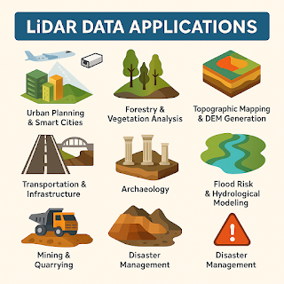
🔟 Top Real-World Applications of LiDAR Data
1. 🏙️ Urban Planning & Smart Cities
-
3D city modeling
-
Utility and infrastructure mapping
-
Building footprint extraction
-
Urban heat island analysis
-
Drainage system and flood modeling
📊 Use Case: Smart city planning in Singapore uses LiDAR to model urban growth and flood zones.
2. 🌲 Forestry & Vegetation Analysis
-
Tree height and canopy density measurement
-
Forest biomass and carbon stock estimation
-
Deforestation monitoring
-
Precision forestry management
📊 Use Case: Amazon rainforest analysis uses LiDAR to detect illegal logging and biodiversity loss.
3. 🌍 Topographic Mapping & DEM Generation
-
Terrain modeling at high resolution
-
Elevation profiling for infrastructure projects
-
Floodplain and watershed mapping
📊 Use Case: USGS uses airborne LiDAR to create nationwide elevation datasets.
4. 🛣️ Transportation & Infrastructure
-
Road condition assessment
-
Bridge and tunnel design
-
Pavement slope analysis
-
Traffic modeling and simulation
📊 Use Case: Highway departments use LiDAR for route planning and hazard detection.
5. 🌧️ Flood Risk & Hydrological Modeling
-
Riverbed and floodplain modeling
-
Catchment area and drainage basin analysis
-
Flood simulation and prediction
📊 Use Case: Netherlands uses LiDAR in real-time flood warning systems and levee design.
6. 🏛️ Archaeology
-
Detection of ancient structures hidden under vegetation
-
Site mapping without excavation
-
Preservation of cultural heritage sites
📊 Use Case: LiDAR revealed lost Mayan cities under dense jungle canopy in Guatemala.
7. ⛏️ Mining & Quarrying
-
Stockpile volume calculation
-
Surface mine pit monitoring
-
Subsidence detection
📊 Use Case: Open-pit mines use UAV-mounted LiDAR for regular volume auditing.
8. 🌋 Disaster Management
-
Landslide susceptibility analysis
-
Earthquake-prone terrain mapping
-
Post-disaster damage assessment
📊 Use Case: Nepal earthquake recovery teams used LiDAR for rapid terrain mapping.
9. 🚗 Autonomous Vehicles
-
Real-time environment perception
-
Obstacle detection and avoidance
-
Lane detection and road edge modeling
📊 Use Case: Tesla, Waymo, and others use LiDAR for advanced driver-assistance systems (ADAS).
10. 🛰️ Precision Agriculture
-
Field terrain modeling
-
Crop health and height monitoring
-
Irrigation optimization
📊 Use Case: LiDAR is used in drone-based crop surveys for optimizing yield.
🛠️ Common Tools & Software for LiDAR Data Processing
| Software | Key Features |
|---|---|
| ArcGIS Pro | 3D analysis, LiDAR to raster, DEMs |
| QGIS + LAStools | Open-source LiDAR point cloud processing |
| CloudCompare | Visualizing & editing point cloud data |
| Pix4D | Drone LiDAR processing & modeling |
| Global Mapper | Terrain modeling, volume calculation |
📊 LiDAR vs. Photogrammetry: What’s the Difference?
| Feature | LiDAR | Photogrammetry |
|---|---|---|
| Data Type | 3D Point Clouds | 2D Images converted to 3D |
| Accuracy | Very High | Moderate |
| Vegetation Penetration | Yes | No |
| Best For | Terrain, canopy, fine detail | Orthophotos, visuals |
🔮 Future Trends in LiDAR Technology (2025–2030)
-
UAV + LiDAR combos for on-demand mapping
-
Real-time 3D streaming LiDAR
-
AI/ML integration for automated object detection
-
Miniaturized LiDAR sensors in smartphones
-
Crowdsourced LiDAR mapping networks
✅ Conclusion
LiDAR is not just a data collection tool — it's a revolution in spatial understanding. Its ability to produce high-resolution, 3D data in any environment makes it an essential technology in 2025 and beyond. Whether you are an urban planner, environmental scientist, disaster manager, or archaeologist — LiDAR is reshaping your world.
💡 As access becomes easier and tools more powerful, the real impact of LiDAR will only continue to grow.


0 Comments